Geography
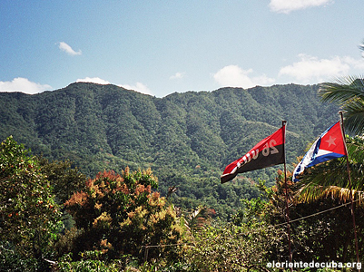
Cuba's terrain consists of mountains in certain areas, but most of the island is low rolling plains across the island. In the coastal parts of the island, you can find many marshes and swamps, the largest being the Zapata Swamp, which takes up an area of 1,750 square feet. The highest point is Pico Turquino, at 6,476 feet above sea level, and the lowest point is at 0 feet above sea level. Mountain ranges in Cuba consist of the Sierra Maestra and Sierra Cristal in the southeast, the Escambray Mountains in the center of the island, and the Sierra del Rosario in the northwest.
Climate
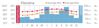
Cuban climate is quite tropical and humid, with a dry season that lasts from November to April, and a rainy season that lasts from May to October.
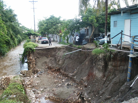
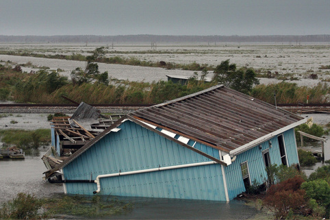
The average temperature in January is 73.6 degrees Fahrenheit, and 80.6 degrees Fahrenheit in July. However, trade winds that pass throughout the island can moderate the temperature. Cuba is located in hurricane paths and these storms are very common throughout September and October. Forming on October 14th, the 1924 Cuban hurricane was the first official Category 5 hurricane in the Atlantic ocean. On October 23rd, the storm crossed the state, causing it to die down to a tropical storm.
Below is a video of the Category 5 hurricane Gustav, that hit Cuba in 2008.